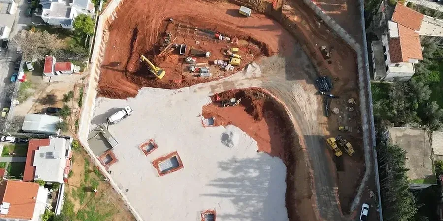
The Southern High Plains present a unique set of constraints for deep excavation work. Lubbock sits on the Llano Estacado, a vast plateau where the Ogallala Formation dominates the subsurface profile. This formation mixes cemented caliche layers with loose aeolian sands. The contrast is stark. A drill bit will hit rock-hard caprock at 5 feet then plunge through uncemented sand at 15 feet. This vertical variability demands a design approach that anticipates abrupt changes in soil stiffness. A uniform shoring section rarely works across the entire cut depth. We often pair pre-excavation site characterization with stratigraphic profiling to map the caprock continuity before selecting a support system. For excavations that extend below the perched water table present in some Lubbock basins, a CPT test provides near-continuous data on pore pressure dissipation and helps define the dewatering strategy early in the design phase.
Caliche in the Ogallala Formation transitions from intact weak rock to granular soil within the same excavation face. A single earth pressure coefficient never captures the full behavior.
Common questions
How does caliche affect deep excavation design in Lubbock compared to normal soil?
Caliche acts as a weak rock with unconfined compressive strengths from 1.5 to 8 MPa. Its stiffness reduces lateral pressures in the short term, but it is brittle and fractures as the cut weathers. The design must assume a transition from rock behavior to granular soil behavior over the construction period. We use a bilinear pressure envelope to cover both conditions and specify shotcrete facing to preserve the caprock's cohesive strength.
What is the typical cost range for a geotechnical deep excavation design package in Lubbock?
The design fee depends on excavation depth, number of support levels, and instrumentation requirements. For a typical 25-foot excavation with soldier piles and one row of tiebacks, the engineering design package ranges from US$2,270 to US$7,330. A deeper cut with multiple anchor rows and a full monitoring plan will be at the higher end of that range.
Do I need a dewatering design for a deep excavation in Lubbock?
It depends on proximity to playa lakes. Perched groundwater exists at 18 to 30 feet below grade in many parts of the city, especially east of Interstate 27. If your excavation bottom is below the seasonal high water table, you need a dewatering plan to prevent base instability and piping in sand layers beneath the caliche.