You can't drive a rigid stem auger through Lubbock's caliche caprock without losing your sample, and that's where we always recommend the cone penetrometer. Lubbock sits on the southern edge of the High Plains, capped by the Ogallala Formation—a dense, cemented layer of calcium carbonate that can be two to ten feet thick, underlain by much softer Pleistocene lake sediments and silt. We run CPT rigs across Lubbock County because the continuous tip resistance and sleeve friction data let us map exactly where that hard caliche transitions into the soft, compressible basin fill below. More than half the foundation claims we review involve a footing that was designed for uniform conditions but encountered a buried paleochannel the driller never saw. Combining CPT with targeted SPT drilling helps us verify refusal depths, and for pavements on the expansive clays of the Yellowhouse Draw floodplain we often pair it with CBR road testing to confirm subgrade modulus across the site.
In Lubbock, the difference between a 2-foot and a 6-foot caliche cap can change your foundation design completely—CPT gives you that boundary to the centimeter.
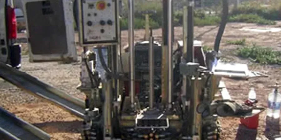
Our approach and scope
Lubbock’s stratigraphy is a textbook case for CPT profiling. The Ogallala caliche cap varies dramatically—thick and massive west of I-27, thin to absent along the Yellowhouse Draw drainage, and completely missing in some neighborhoods built over playa lake basins. Our 20-ton CPT truck pushes a 15 cm² cone at a standard rate of 2 cm/s, recording tip resistance (qc), sleeve friction (fs), and dynamic pore pressure (u2) every centimeter through the profile. In saturated silts below the caprock we can measure dissipation curves to confirm the static water table, which sits shallow at 30 to 50 feet across much of the city, feeding the underlying Ogallala Aquifer. When we encounter refusal on the caliche, we switch tactics and use test pits to examine the caprock thickness directly, then resume CPT through a pre-drilled pilot hole. We interpret the data using Robertson’s (1990) soil behavior type classification, which gives us a normalized SBT chart that engineers can drop straight into their bearing capacity calculations—particularly useful for the mixed fills and lake sediments that characterize the Mackenzie Park area and the industrial zones east of the airport.
Local ground factors
We’ve seen two Lubbock sites less than a mile apart behave completely differently. A multi-story building near Texas Tech, founded on 8 feet of solid caliche, settled less than half an inch after two years of monitoring. A warehouse just south of 50th Street, built on what looked like similar ground but actually overlying a silt-filled playa depression, experienced differential settlement of nearly 3 inches in the first wet season because the contractor never mapped the soft lens under the caprock. That’s the risk CPT eliminates. Without a continuous profile, the driller can hit refusal at 3 feet, call it competent ground, and never know there’s 10 feet of compressible silt sitting right below the caliche. In the southern parts of the city where the Ogallala thins out, we often recommend a plate load test on the exposed caprock surface to verify the deformation modulus directly, especially when the CPT pore pressure data suggest perched water trapped above the caliche layer.
Common questions
What does CPT testing cost for a site in Lubbock?
For a standard CPT sounding in the Lubbock area, you can expect to pay between US$170 and US$220 per test, depending on the depth of refusal, whether we need to pre-drill through caliche, and how many dissipation tests you require. Mobilization to the South Plains is calculated separately based on the number of soundings and the distance from our staging yard.
How deep can the CPT rig penetrate Lubbock’s caliche caprock?
The cone will typically refuse on the Ogallala caliche between 2 and 10 feet below grade, depending on the cementation and thickness of the caprock. We do not try to push through it—instead we pre-drill a pilot hole through the caliche layer, case it if necessary, and then resume the CPT sounding in the softer silts and clays beneath. This gives you a continuous profile without damaging the cone or losing data quality.
What soil parameters does the CPT provide for foundation design?
The CPT records tip resistance (qc), sleeve friction (fs), and pore pressure (u2) every centimeter. From these we derive the soil behavior type (SBT) using Robertson’s normalized charts, undrained shear strength (Su) for the clays, relative density (Dr) for any sands, and constrained modulus (M) for settlement calculations. You can use these values directly in bearing capacity and settlement analyses per IBC Chapter 18.
Do you need a drilling permit to run CPT in the city of Lubbock?
CPT is a minimally invasive push test with no cuttings or drilling fluid, so it generally does not require the same permits as a conventional drill rig. That said, if your site is within a public right-of-way, near a utility corridor, or in a floodplain zone along the Yellowhouse Draw, we coordinate with the City of Lubbock Engineering Department to confirm any right-of-way or environmental clearances before mobilization.
Can CPT data replace SPT blow counts for liquefaction analysis in Lubbock?
Yes, CPT data is actually preferred for liquefaction triggering analysis because it provides a continuous, repeatable profile without the energy corrections and hammer variability that affect SPT N-values. In Lubbock, the liquefiable layers are typically the saturated silts and fine sands found below the Ogallala caprock in the playa lake basins. We run the CPTu with pore pressure measurement, apply the Robertson and Wride (1998) or Boulanger and Idriss (2014) triggering procedures, and deliver a factor of safety profile that integrates directly with your seismic hazard assessment under ASCE 7.